The region
As the scouts of the Kings of Daleth came to the Weslanan, they saw a huge mountain range in the south. The sun was behind it, and low, lighting the sky in orange and violent hues. The mountains seemed to be enormous solid shadows, pitch black. And so they got their name: De Zwarte Bergen (the Black Mountains).In normal sunlight, the rocks of the Black Mountains were darker than the chalk stone that gave its name to the White Mountains.
The Black Mountains are smaller but higher than the White Mountains, and more suited for romantic dreams of adventure - they form the decor to many novels. The mountains formed a natural barrier between the Weslanan in the north and Salamandran in the south, with only two roads to pass them: the narrow and dangerous road to and from Scholvan and the easier to travel roads to and from Gronbrunlar. Some small paths lead from Tarnov into the mountains, but these are no serious roads for travelling.
Due to heavy snowfall in winter, large parts of the Black Mountains are not accessible in that season. The Scholvan citizens try to keep the roads clear, but they can not shovel against the snowfall.
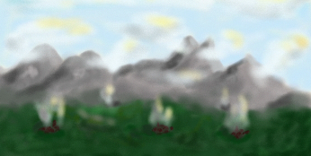
Black Mountains in the Morning Mists, by Lemhain Garwendz
Middagstop
The highest mountain in the Black Mountains is the Middagstop (Mount Noon, Noon Peak), that sticks out like a tower from the rest of the mountain range. It is a landmark, visible from as far as Unvar on a clear day.It is supposed to be impossible to climb this mountain, with its barren, wild sides, steepening to the sky, and its dangerous climate near the peak, where wet mists and clouds whirl in a very cold wind.
Those heroes who tried to climb Mount Noon all died. Their bodies have been buried in a cave at the foot of the mountain - as far as they have been found. But the fatal challenges are not stopped. The legends have it that a large Himinst can be found at the top. When the light of Lukarna is reflected by the Himinst, it can be seen from a long way away and forms thus a beacon for many travellers.
How a stone that is found only near Kristalmeer can end up high on a mountain is still not explained. The believers of the legend tell a dragon has been to Kristalmeer, took the stone and placed it on the Middagstop. Now, it feeds on the people who climb the mountain and fall off. It is supposed to be a very fat dragon, who now is unable to fly.
Scholvan County
The count of Scholvan rules the Black Mountains. Practically all land in the Black Mountains belongs to Scholvan - with everything in, on, over and under it. It were the mines that were Scholvans sole source of income. The minerals found there, and the gemstones that came from it were sold for a lot of money in the cities. In exchange, the people of Scholvan had to by food, for the Black Mountains are not suited for agricultural activities. Thus, Scholvan did not get rich from Airthas treasures.The counts soon found another source of income: tolls, taxes and robbery. Toll houses were build at the place where the valley of the Stainrhen got narrow, and halfway the road between Gronbrunlar/Ciniz and Scholvan. Everyone who passed the Black Mountains through Scholvan had to pay the toll, an amazing two Skilliggs were asked to pass Scholvan (one when entering, one when leaving). As the Emperor ordered more service for the high toll, the toll rate decreased, but a far more annoying thing was established: the guild of highwaymen, the Masked Men - thieves, robbers, villains- took the road and found the travellers who could not escape were a nice prey for their needs. The Emperor ordered his armed forces to clean the narrow Scholvan Valley, but they did not really succeed - the Masked Men seemed to disappear into thin air at times.
It was not really surprising some of the Masked Men were in fact women, but the imperial forces were very surprised to find out the chief of the band was the count of Scholvan himself... the headquarters of the Masked Men was the Castle of Scholvan, a castle build partially in the mountains, with a labyrinth of tunnels spreading from there into the more remote parts of the mountains. It were these tunnels with hidden entrances the Masked Men used to get away from the imperial forces.
Scholvan County hardly has agricultural lands. A few patches are used to grow crops, but the harvest is poor. In earlier days, when the harvest was really bad, the citizens of Scholvan raided the area as far as Isauls, Hveitsvar and Dernëv to steal their food together.
This situation only ended when the Emperor ordered the Scholvanians to go to the Haithyan and grow their own crops in that region. Have of the Haithyan than can to Scholvan, the other half stayed in the lands of Hveitsvar.
Hoochweg
The road leading from Scholvan to the east is called the Hoochweg. It is not a road in the sentence of the law. The road is not paved, and very narrow at places. Carriages - wheeled vehicles in general - can not go over the Hoochweg. Avalanches and landslides change the road almost each year, and parts of the road are hardly recognisable as a road. Marks and sign must show the way to the next save haven, but get also destroyed by avalanches, landslides and falling stones. A guide might be very useful, especially as the citizens of Scholvan persist of being your guide - if you take of alone, they know you are alone, and you run a high risk of getting robbed by the Masked Men.The condition of the Hoochweg forced the engineers of Scholvan to design a wheelless, horseless carriage, for the Emperor who would occasionally inspect this county during the age of the United Empires. They invented a small cupboard like chest, with doors on two sides, and windows on all sides. Inside is a seat, where the Emperor can sit dry and comfortable, with a view to all sides. For long poles allow this "Scholvanian Carriage" to be carried by as much as eight humans. They would have no difficulty to carry the Emperor over the Hoochweg.
This kind of carriage is still popular among the upper class in less accessible areas and in the busy cities. However, it can be a drag to find people who should carry the Scholvanian. Note that not everyone is suited for the job: all carriers should be approximately equally tall and know how to march at the same speed without shaking the Scholvanian too much.
Poort van het Zuiden
The road south of Scholvan was, seen from the Weslanan, the door to the southern regions of Daleth: hence the name Poort van het Zuiden (Door of the South). It basically is the valley of the Stainrhen, and the mountains form a natural door. The road starts at Scholvan Castle and ends at the "Tolwachter van het Zuiden" (The Toll guard of the South) where a real door was build to gather the toll.However, the narrowest part of the road is a few stond more north, and is still a spectacular sight. The rocks rise up high, topped with some overhanging trees. It is also the place where the Masked Men loved to tumble down on travellers, rob them, and climbed the rocks to disappear to somewhere out of sight.
That narrow site is also the place where a temple to Aaser has been build. The altar is placed on the roadside. Next to it a carved pole shows how high the water rose up in this gorge in the last two centuries - it is not the original pole, earlier versions have been swept away by the water, but luckily a copy is kept in Scholvan Castle.
People who fell in the gorge, drowned and were never seen again are commemorated here as sacrifices to Aaser.
Tolwachter van het Zuiden
"Tolwachter van het Zuiden" used to be just a guarded toll house. But as soon as a guesthouse had been build next to it, and additional services were offered (blacksmith, bakery, tavern, shady orchards) the spot turned into a hamlet. The hamlet gained importance only recently as the executives of the Sterrenbos industry used the "Tolwachter" as a resting place on a nice day out with the Tainjo.Then, the upper class of Hveitsvar "discovered" this tranquil area with its beautiful nature, and headed their horses this way. Eventually, the people from cities further away came with their carriages to spend the holy days here. The inhabitants of the hamlet jumped onto the commercial opportunities and build more taverns and guesthouses, a dance hall with a exquisite salon, and some small shops, among several other additional services.
Stainrhen River
The Stainrhen has its source deep in the Black Mountains, or rather under it. Near Scholvan it comes to the surface in a gorge. The gorge forms the natural moat of Scholvan Castle, and is an amazing 20 fathom deep at the point where the gorge is crossed by the bridge.The wild river soon gets more tranquil, widens up to a slow flowing stream with little isles, gentle rippling cascades and perfect fishing spots. But in the wrong season, the water turns into a turmoil of water, violent vortexes, ripped off branches and speeding pebbles. A very dangerous place to be, and sometimes the river swallows the road as well. Landslides are natural in such circumstances, and the rubbish resulting is taken with the water.
The Stainrhen is famous for its gemstones. Fishermen have found many shiny stones in the basins lining the banks. Some have found some gold. However, what is found belongs to the count of Scholvan and the guards at the Tolwachter search very good when they think gold or gems are smuggled out of the county.
South of the Tolwachter, the Stainrhen gets navigable with small, flat bottomed boats, usually made out of a single, hollowed tree, or raft-like vessels. But the Stainrhen never is navigable in a more commercial way to transport goods or people.
Hoge Val and the Tar Source
Just north of Scholvan is the source of the Tar River. There is no real source of this river, there are just small cold streams flowing together, and then gathering at a long quiet lake just before the Hoge Val. The Hoge Val is where the lake tumbles over the edge and forms a long waterfall - the highest waterfall of Daleth.At the foot of the Hoge Val is a strange hill, solitary in the landscape. A few skeletons have been discovered inside the hill. What this Grafheuvel (grave hill) actually is or whom the skeletons belonged to remains a mystery, although the folk of the region do have some explanations for it. They say it is the place where the first human being who stood up against the gods was buried by Gräins. The place is very holy, and on Gräins day there are made sacrifices to Gräins. In earlier days, a long procession walked from Dernëv to the Grafheuvel. There, humans were sacrificed by ripping their hearts out, and let the blood flow over the grave hill. The bodied would be buried in the hill, next to the First Human.
Because these sacrificed people were not properly buried, and their splinters still roam our plane of existence, the place is now haunted. The ghostly forms the splinters live in look much like humans, hiding in the bushes near the Grafheuvel. Whoever comes to close, might find his heart ripped out before he realises he is dead. Bloody remains of bodies have been found on the Grafheuvel in recent times.
The priests deny it, but there might be a cult similar to the Molik cult in the Weslanan. Authorities say the remains are from animals, killed illegal by poachers. Others say the skeletons are from the rabbit folk who live near the Hoge Val. This rabbit folk has long ears like rabbits and dig large holes in the earth, in which they live. The Grafheuvel is such a hole, that has collapsed and thus trapped and killed the rabbit folk living in it. Folklorist say the story of the rabbit folk is humbug and only told because the one studying the Grafheuvel asked questions in that direction ("Can the Grafheuvel have been made by rabbits?" "Oh yes, it was the rabbit folk who dug it!")
Gronbrunlar Valley
Where the White and Black Mountains come together, is Gronbrunlar Valley. The wide, almost round valley is a cultural crossroad of high importance. To the north, the roads to Scholvan and De Weslanan wind their way into the mountains. In the east, a wide valley is the picturesque landscape the road to De Erflanden leads through. And in the south, the narrow valley of the Wyz River gives access to Salamandran.The middle of the valley is the bluish green lake with Gronbrunlar on its northeastern bank. It is assumed the Valley is in fact a very old crater of a volcano that died, and that the lake still gives access to the Source of Airtha if only you dive deep enough.
Facing the south, and sheltered from heavy storms, Gronbrunlar Valley has a good climate, and even on this high altitude (Gronbrunlar is one of the highest towns of Daleth) the flora grows very well. This made Gronbrunlar an independent county and wealth was accessible for almost all citizens. Hunger, like in Scholvan, they do not know here.
However, Gronbrunlar Valley is not famous for its agricultural development, but for its gemstones. In the lake, in the mountains, in some small mines the minerals containing the most beautiful and thus valuable gemstones can be found. The craftsmen of Gronbrunlar know how to cut and polish the stones to perfection. Nearby silver mines provide the silver needed to turn the stones into real jewellery, as the silversmiths make Daleths most expensive rings, bracelets, buttons, and other things needed by the upper class. The silversmiths of Gronbrunlar are the ones who have made the majestic crowns for the Emperor and his family.
Next to the green lake is a temple to Aaser. It is the only temple were Aaser is depicted as female. Priests do not want to listen to the scientists who think the temple might be older than the Poorterian culture and than the naked woman on the frescoes is actually a much older goddess or a water spirit, called "Queen of the Lake" or "Airtha" (she should depict the Mother of all Life of an ancient cult with strange, mystic rites). The temple is the centre of the Gronbrunlar spa culture. It is here where the priests have developed a water therapy that should cure a range of illnesses and diseases.
Brede Dal
East of Gronbrunlar Valley, the Brede Dal slowly lowers itself to De Erflanden. This wide valley is the main agricultural area of Gronbrunlar, with wheat fields, orchards, and an abundance of vegetable fields; the cattle is held higher up the mountain slopes, where the soil is less suited for growing crops.The rich of Gronbrunlar have their mansions here in the Brede Dal, and guesthouses have been build to host the patients for the water therapy of Aasers temple. Tranquil and rural as this might seem, it is in fact a rather busy road that forms the backbone of the valley.
Wyz River
From the green lake of Gronbrunlar, the Wyz river cascades to Donvar, winding itself through a narrow valley. Next to the river is the road, and one has to be careful to stay on the road and not fall in the cold, whirling water of the Wyz.On the banks of the river grow dark, high trees, a sombre sight for a tired traveller. In these woods, wild animals hide, like bears and wolves. Sometimes, the woods are cleared, and half of the trees is cut away. The tree trunks are sold to Donvar or the Wymarer shipyards, and dropped in the river. The water will take the trunks to their destination.
Felez Felthan
The eastern end of the Black Mountains is called Felez Felthan, the lower part of the Brede Dal (The Wide Valley). It is a very wide, smooth valley from Gronbrunlar County down to De Erflanden, with the remains of a glacier that has been there until the early 12th century. The glacier reached as far as Lazulameir and made the lake there. The soil and the rocks here contain much iron ore. The rocks are split and grind and then gathered, taken to Wymar for heating them and getting the iron out of it.The transport down the slope is done by the so called millstone road: a track between boards, bricks and carved rocks, where the stones are thrown in and then brought down by gravity. At the end of the track, a cart is waiting to get filled. Travellers can cross the millstone road over the wooden bridges. Many stop to watch the stones roll by, making a thunderous noise - quite a sight in this dull landscape.
"The Felez Felthan are great to grow rocks," the people from Gronbrunlar say, "and nothing else will grow there". And rocks are there by the lots - large ones, long ones, small ones, tall ones, decorated with pebbles and flints. Some hesitating plants might sprout here, but are quickly eaten by Kamzyg and other animals. A famous plant is the Wrisqaiz - a large stone coloured bulb (a bit reddish like the stones on Felez Felthan) that flowers when it gets wet and leave behind a strong perfume. Long roots keep the bulbs in place and give the necessary nutrition to the bulb too survive the dry periods. The plants are very popular to urinate on: they will flower in the stream. Some people carry the Wrisqaiz home and put them in the toilet - as a gimmick for guests, but also for the perfume.
On some of the larger rocks, on cliffs and strategic mountainside spots the remains of watch towers can be found. These primitive buildings are often seen as Sudzi architecture, dating from the Age of the Giants, or Naglani strongholds from the 9th and 10th century. Actually, these "primitive" artifacts are hastily build strongholds of the Gronbrunlarians to keep the troops of the Emperor out of their county. Still, the Felez Felthan are a weak spot in the defence system of Gronbrunlar, and some of the watch towers are still in use - as toll houses, but as more hostile architecture if necessary.
Guesthouse De Grot
Halfway Ciniz and Gronbrunlar there is a guesthouse. The Emperor himself has ordered to build this guesthouse for his heralds. However, the engineers found the gorge of the Cin too narrow to build in it. They went there, measured and calculated, but could find not one spot to build a good guesthouse. Tired of walking in the mountains, they rested in a cave, some paces higher than the road. They ate there and spend the night in it before they went back to Ciniz.On the way back, they had the idea of enlarging the cave and build the guesthouse in the mountainside. And so they went to Ciniz University and made further calculations, based on the knowledge of the Black Mountains already available. And so they designed Guesthouse "De Grot" as it still is.
The entrance of the original cave can be reached by wide stairs, giving access to the taproom. On ground level are the stables and the storage rooms. Next to the original cave is the kitchen, with behind it the private rooms of the innkeeper. Upstairs are the guest rooms, the expensive ones with windows and a view into the loud Cin Gorge, the cheap ones in the mountain without any windows.
Dragons
Legends tell of dragons living in the Black Mountains. Numerous caves, holes, ravines, gullies, gorges, peaks, mountains, hills, rocks and other landmarks have been named after this legendary beast. The beast itself, and his apparently large horde, have never been found. But that does not mean the dragons do not exist, so the inhabitants of the mountains say. Reported missing sheep and goats, strangely mutilated Kamzyg and other weird events in the mountains are all prove there are actually dragons, maybe up the mountain tops, maybe deep under the rocks, near the Source of Airtha.Sterrenbos and Haithyan
The Sterrenbos is a dark pine wood on the southern slopes of the Black Mountains. For more information read the chapter on Sterrenbos. Idem for more information of the Haithyan corner of the Scholvan County.Related topics: